Uttarakhand
Home / Guides / Uttarakhand
North India · State

Uttarakhand

Land of the gods

Photo: Rohit Sharma, CC BY-SA 4.0
Capital

Dehradun (winter), Gairsain (summer)

Best time to visit

March to June and September to November

Getting there

Fly to Dehradun (Jolly Grant) or Pantnagar, or take a train to Haridwar or Kathgodam.

Ideal trip

10 to 14 days to cover the highlights

About Uttarakhand

Uttarakhand is home to the Char Dham pilgrimage, the yoga capital Rishikesh, Himalayan treks and Jim Corbett, India's first national park.

Plan a trip to UttarakhandMark it on my map

Popular cities in Uttarakhand

Been to any? Mark them on your India travel map.

AlmoraAuliBadrinathDehradunHaridwar (Hardwar)KedarnathMussoorieNainitalRishikesh

Top places in Uttarakhand

RishikeshPhoto: VK1983, CC BY-SA 4.0

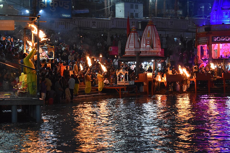
Rishikesh

Yoga ashrams, Ganga aarti and white-water rafting.

Best time: September to November, February to MayBase: Rishikesh2 daysSpiritualAdventure
Directions
From Wikipedia

Rishikesh or Hrishikesh is a municipal corporation and tehsil of the Dehradun district of the Indian state Uttarakhand. It is situated on the right bank of the Ganges river and is a pilgrimage town for Hindus associated with famous sages and yogis. There are numerous temples and ashrams built along the banks of the river. Nicknamed the "Gateway to the Garhwal Himalayas", Rishikesh is a vegetarian-only and alcohol-free city.

Read more on Wikipedia ↗

Video by Pralhad Konnur on YouTube

Valley of FlowersPhoto: Rohit Sharma, CC BY-SA 4.0

Valley of Flowers

A UNESCO-listed alpine valley that blooms from July to September. Trek from Govindghat.

Best time: July to SeptemberBase: Joshimath3 daysNatureAdventureMountains
Directions
From Wikipedia

Valley of Flowers National Park is an Indian national park which was established in 1982. It is located in Chamoli in the state of Uttarakhand and is known for its meadows of endemic alpine flowers and the variety of flora. This richly diverse area is also home to rare and endangered animals, including the Asiatic black bear, snow leopard, musk deer, brown bear, red fox and blue sheep. Birds found in the park include Himalayan monal pheasant and other high-altitude birds.

Read more on Wikipedia ↗

Video by Travel Bug -SJ on YouTube

Jim Corbett National ParkPhoto: Soumyajit Nandy, CC BY-SA 3.0

Jim Corbett National Park

India's oldest national park, famous for tigers and the Ramganga river.

Best time: November to JuneBase: Ramnagar2 daysWildlifeNature
Directions
From Wikipedia

Jim Corbett National Park is a national park in the Nainital district of the state of Uttarakhand, India. It was established in 1936 as the country's first national park and is named in honour of Jim Corbett, who had played a leading role in its establishment. It was the first to come under the Project Tiger initiative and encompasses an area of 520.8 km2 consisting of hills, riverine belts, marshy depressions, grasslands and a large lake at an elevation range of 400–1,220 m.

Read more on Wikipedia ↗

Video by Anupama Anandkumar on YouTube

NainitalPhoto: Skalvanov, CC BY-SA 4.0

Nainital

A lake town of boat rides, the Mall Road and Himalayan viewpoints.

Best time: March to June, September to NovemberBase: Kathgodam2 daysMountainsNature
Directions
From Wikipedia

Nainital, formerly anglicized as Naini Tal, is a town and headquarters of Nainital district of Kumaon division, Uttarakhand, India. It is the judicial capital of Uttarakhand, the High Court of the state being located there and is the headquarters of an eponymous district. It also houses the Governor of Uttarakhand, who resides in the Raj Bhavan. Nainital was the summer capital of the United Provinces.

Read more on Wikipedia ↗

Video by Grishma Udayawar on YouTube

KedarnathPhoto: Shivam Kumar 766, CC BY-SA 4.0

Kedarnath

A Jyotirlinga temple at about 3,580 m, reached by a 16 km trek. Open May to November.

Best time: May to June, September to OctoberBase: Sonprayag2 daysSpiritualMountainsAdventure
Directions
From Wikipedia

Kēdāranātha Temple is a Hindu temple, one of the twelve jyotirlinga of Śiva. The temple is located on the Garhwal Himalayan range near the Mandākinī River, in the state of Uttarakhand, India. Due to extreme weather conditions, the temple is open to the general public only between the months of April and November. During the winters, the vigraha of the temple is carried down to Ukhimath to be worshiped for the next six months.

Read more on Wikipedia ↗

Video by Kanishk Gupta on YouTube

HaridwarPhoto: pavankunar, CC BY-SA 4.0

Haridwar

The gateway to the Char Dham, famous for the Ganga Aarti at Har Ki Pauri.

Best time: October to AprilBase: Haridwar1 daySpiritual
Directions
From Wikipedia

Haridwar is a city and municipal corporation in the Haridwar district of Uttarakhand, India. With a population of 228,832 according to 2011 census, it is the second-largest city in the state and the largest in the district. Haridwar is located at the south western part of the state. The city is situated on the right bank of the Ganges river, at the foothills of the Shivalik ranges. Haridwar lies in a doab region where people speak Khari Boli, which is a dialect of Hindi.

Read more on Wikipedia ↗
MussooriePhoto: Paul Hamilton, CC BY-SA 2.0

Mussoorie

The Queen of the Hills, with Mall Road, Kempty Falls and the quiet Landour cantonment.

Best time: March to June, September to NovemberBase: Mussoorie2 daysMountains
Directions
From Wikipedia

Mussoorie is a hill station and a municipal board in the Dehradun district of the Indian state of Uttarakhand. It is about 26 kilometres from the state Winter capital Dehradun and 289 km north of the national capital of New Delhi. The hill station is in the foothills of the Garhwal Himalayan range. The adjoining town of Landour, which includes a military cantonment, is considered part of "greater Mussoorie", as are the townships Barlowganj and Jharipani. Mussoorie is at an average altitude of 2,001 metres.

Read more on Wikipedia ↗
AuliPhoto: Vaibhav 369, CC BY-SA 4.0

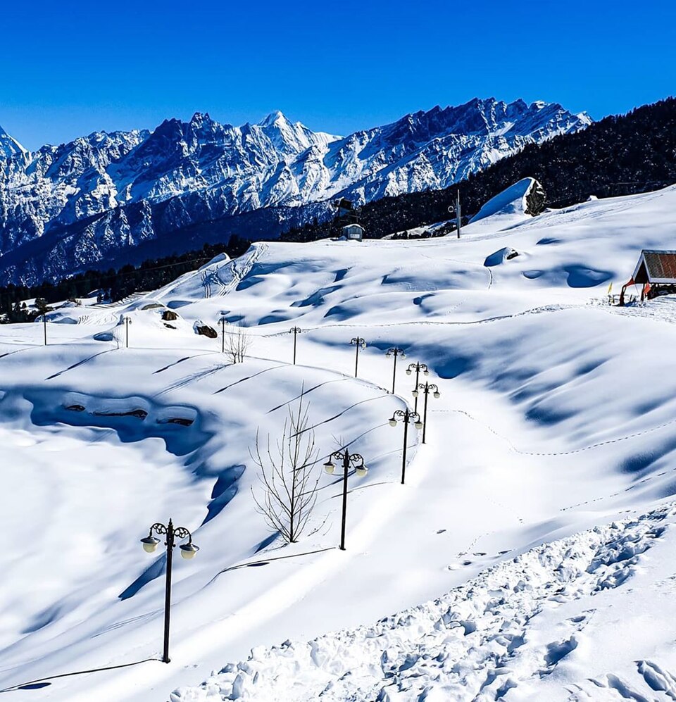
Auli

India's best-known ski slopes, with a long ropeway and views of Nanda Devi.

Best time: December to March, May to JuneBase: Joshimath2 daysMountainsAdventure
Directions
From Wikipedia

Auli is in Chamoli district in the Himalayan mountains of Uttarakhand, India. Auli, also known as Auli Bugyal, in Garhwali, which means "meadow", is located at an elevation of 2,800 metres above sea level. Between June and October, the valley has one of the highest numbers of flower species found anywhere in the world, with 520 species of high-altitude plants, 498 of which are flowering plants with significant populations of endangered species.

Read more on Wikipedia ↗
BadrinathPhoto: Anubha khare, CC BY-SA 4.0

Badrinath

One of the Char Dham, a Vishnu temple at 3,300 m beside the Alaknanda, near Mana village.

Best time: May to June, September to OctoberBase: Badrinath2 daysSpiritualMountains
Directions
From Wikipedia

Badarinath Temple, also known as Badarinarayana Temple, is a Hindu temple dedicated to Vishnu. It is located in the town of Badrinath in Chamoli district of Uttarakhand, India. The temple is one of the 108 Divya Desams, sacred to Vaishnavism, where Vishnu is worshipped as Badrinath. Due to extreme weather conditions in the Himalayas, the temple is open for six months each year, from late April to early November.

Read more on Wikipedia ↗
Almora and BinsarPhoto: SudiptoDutta, CC BY-SA 3.0

Almora and Binsar

Kumaoni culture in Almora and Himalayan sunrise from the Binsar forest sanctuary.

Best time: March to June, September to NovemberBase: Almora2 daysMountainsNature
Directions
From Wikipedia

Binsar Wildlife Sanctuary is an Indian wildlife sanctuary. Binsar was the summer capital of the Chand Kings, who ruled over Kumaon from the 11th to the 18th centuries AD. The British also used it as a summer capital, and built several estates inside the forest. In 1988, Binsar was established as a sanctuary for the conservation and protection of the shrinking broad leaf oak forests of the Central Himalayan region. It has over 200 species of birds.

Read more on Wikipedia ↗
Gangotri and YamunotriPhoto: Dhwani Shree, CC BY-SA 4.0

Gangotri and Yamunotri

The sources of the Ganga and Yamuna, two of the Char Dham, deep in the Garhwal Himalaya.

Best time: May to June, September to OctoberBase: Uttarkashi3 daysSpiritualMountains
Directions
From Wikipedia

Gangotri is a town and a Nagar Panchayat in Uttarkashi district in the state of Uttarakhand, India. It is 99 km from Uttarkashi, the main district headquarter. It is a Hindu pilgrim town on the banks of the river Bhagirathi – the origin of the river Ganges. The town is located in the Greater Himalayan Range, at a height of approximately 3,200 metres. According to a popular Hindu legend, the goddess Ganga descended here when Shiva released the mighty river from the locks of his hair.

Read more on Wikipedia ↗
ChoptaHidden gemPhoto: Alok, CC BY-SA 3.0

Chopta

Meadows that lead to Tungnath, the highest Shiva temple, and Chandrashila peak.

Best time: March to May, September to DecemberBase: Ukhimath2 daysMountainsAdventureNature
Directions
From Wikipedia

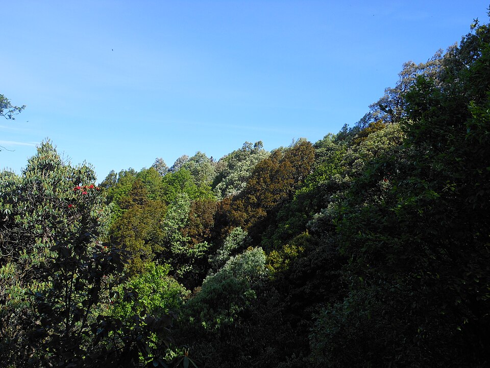
Chopta is a small region of meadows and evergreen forest area, a part of Kedarnath wildlife sanctuary located in Uttarakhand state, India and a base for trekking to Tungnath, the third temple of Panch Kedar which lies 3.5 kilometres away. Located at a distance of 1.5 kilometres from Tungnath is Chandrashila, a summit rising to over 4,000 metres.

Read more on Wikipedia ↗

Video by The Himalayan Diary on YouTube

MunsiyariHidden gemPhoto: Ashish Gupta from Noida, India, CC BY 2.0

Munsiyari

A Kumaon village facing the five Panchachuli peaks, the base for Milam glacier treks.

Best time: March to June, September to NovemberBase: Munsiyari2 daysMountainsAdventure
Directions
From Wikipedia

Munsyari is the name of the sub-division headquarters, a municipal board, a conglomeration of revenue villages and it also refers to the entire region as Munsiyari Tehsil and Sub Division in the Pithoragarh District in the hill-state of Uttarakhand, India. It is a hill station and lies at the base of the great Himalayan mountain range, at an elevation of about 2,200 m and is a starting point of various treks into the interior of the range.

Read more on Wikipedia ↗
Har Ki DunHidden gemPhoto: Metanish, CC BY-SA 4.0

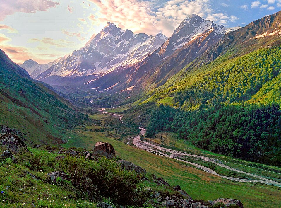
Har Ki Dun

A cradle-shaped valley trek past ancient wooden villages in Govind Pashu Vihar.

Best time: April to June, September to NovemberBase: Sankri3 daysAdventureMountains
Directions
From Wikipedia

Har Ki Doon or Har Ki Dun is a cradle-shaped hanging valley in the Garhwal Himalayas of Uttarakhand, India. The region is surrounded with green Bugyals. It is surrounded by snow-covered peaks and alpine vegetation. It is connected to Baspa Valley by the Borasu Pass. This valley is about 3566 m above mean sea level and is snow-covered from October to March.

Read more on Wikipedia ↗

Food to try

Kafuli, aloo ke gutke, bhatt ki churkani, bal mithai, singodi

Where to stay

Rishikesh and Haridwar for the Ganga, Nainital and Mussoorie for hills, GMVN rest houses on pilgrim routes

Getting around

Trains to Haridwar, Dehradun and Kathgodam; shared taxis and buses in the hills

Good to know

Register online for the Char Dham Yatra. Avoid mountain roads in heavy monsoon rain (July to August).

Uttarakhand: quick answers

What is the best time to visit Uttarakhand?

March to June and September to November

How do I reach Uttarakhand?

Fly to Dehradun (Jolly Grant) or Pantnagar, or take a train to Haridwar or Kathgodam.

How many days do I need for Uttarakhand?

Plan 10 to 14 days to see the highlights, such as Rishikesh, Valley of Flowers, Jim Corbett National Park.

What food should I try in Uttarakhand?

Kafuli, aloo ke gutke, bhatt ki churkani, bal mithai, singodi

Where should I stay in Uttarakhand?

Rishikesh and Haridwar for the Ganga, Nainital and Mussoorie for hills, GMVN rest houses on pilgrim routes

Neighbouring states

Timings, fees, permits and road conditions change. Please check official sources before you travel.