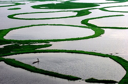
Mizoram
Home / Guides / Mizoram
Northeast India · State

Mizoram

Bamboo hills and blue mountains

Photo: GeoEvan, CC BY 4.0
Capital

Aizawl

Best time to visit

October to March

Getting there

Fly into Aizawl (Lengpui). Roads connect from Silchar in Assam.

Ideal trip

3 to 5 days to cover the highlights

About Mizoram

Mizoram is a peaceful state of steep ridges, bamboo forests and close-knit villages. Indian visitors need an Inner Line Permit.

Plan a trip to MizoramMark it on my map

Popular cities in Mizoram

Been to any? Mark them on your India travel map.

AizawlChamphaiLungleiSerchhip

Top places in Mizoram

AizawlPhoto: GeoEvan, CC BY 4.0

Aizawl

A capital built on ridges, with lively markets and views from every corner.

Best time: October to AprilBase: Aizawl2 daysCityCulture
Directions
From Wikipedia

Aizawl, formerly known as Aijal, is the capital city and the most populous city of Mizoram, India. It is also the third largest city in northeast India. It is situated atop a series of ridges, with an average elevation of around 1,132 metres above sea level. In 2024, the city has an estimated population of 415,000 people.

Read more on Wikipedia ↗

Video by Swathi Hariharan on YouTube

Vantawng FallsHidden gemPhoto: Georgeluvpotato, CC BY-SA 4.0

Vantawng Falls

The highest waterfall in Mizoram, set in thick bamboo forest near Thenzawl.

Best time: October to AprilBase: Thenzawl1 dayNature
Directions
From Wikipedia

The Vantawng Khawhthla is located 5 kilometres south of Thenzawl in Serchhip district in the Indian state of Mizoram. It is the highest uninterrupted waterfall in Mizoram. It is about 92 kilometres away from Aizawl.

Read more on Wikipedia ↗

Video by Ken Murray on YouTube

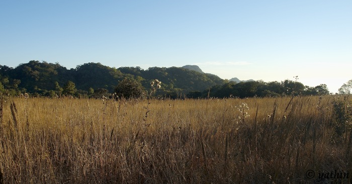
Phawngpui (Blue Mountain)Hidden gemPhoto: Yathin S Krishnappa, CC BY-SA 3.0

Phawngpui (Blue Mountain)

The state's highest peak, a national park with rhododendrons and rare birds.

Best time: October to AprilBase: Sangau2 daysMountainsNatureAdventure
Directions
From Wikipedia

Phawngpui, also known as Blue Mountain, is the highest mountain peak in the Mizo Hills and in the state of Mizoram, India, with an elevation of 2157 m. It is in Lawngtlai district, in the southeastern region of Mizoram near the Myanmar border.

Read more on Wikipedia ↗

Video by Tehzoon - Wilderness Explorer on YouTube

ReiekHidden gemPhoto: Coolcolney, CC BY-SA 3.0

Reiek

A ridge near Aizawl with a heritage village of traditional Mizo houses and views into Bangladesh.

Best time: October to AprilBase: Aizawl1 dayMountainsCulture
Directions
From Wikipedia

Reiek is a mountain and tourist spot 29 km from Aizawl, Mizoram, India. It rests at an elevation of 1,465 metres overlooking Aizawl and offers a view of the surrounding valleys and hills. On a clear day, the plains of Bangladesh can be seen from the top of the hill. Reiek Hill is surrounded by thick lush green temperate trees and bushes.

Read more on Wikipedia ↗
ChamphaiHidden gemPhoto: Bogman, CC BY-SA 3.0

Champhai

The rice bowl of Mizoram on the Myanmar border, with Rih Dil lake and old memorial stones.

Best time: October to AprilBase: Champhai2 daysNatureCulture
Directions
From Wikipedia

Champhai is the third largest town in Mizoram, northeast India and is one of the oldest settlements founded by the Mizo people that initially served as a capital for the Hmar dynasty. Located near the India–Myanmar border, it facilitates cross-border trade and serves as a hub for trade and commerce in the region. Unlike most urban places in Mizoram, Champhai is situated in a valley and on top of a small hill. It is situated at an elevation of approximately 1,678 meters above sea level.

Read more on Wikipedia ↗
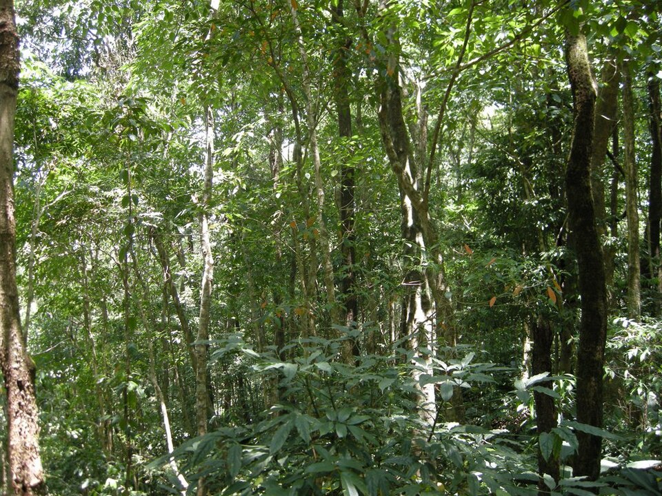
Dampa Tiger ReserveHidden gemPhoto: Coolcolney, CC BY-SA 3.0

Dampa Tiger Reserve

Mizoram's largest sanctuary, with hoolock gibbons, clouded leopards and rich birdlife.

Best time: November to AprilBase: Dampa2 daysWildlifeNature
Directions
From Wikipedia

Dampa Tiger Reserve or Dampha Tiger Reserve is a tiger reserve in western Mizoram, India. It covers an area of about 500 km2 in the Lushai Hills at an elevation of 800–1,100 m. It is the largest wildlife sanctuary in Mizoram. It was declared a tiger reserve in 1994 and is part of Project Tiger. The tropical forests of Dampa Tiger Reserve are home to a diverse flora and fauna.

Read more on Wikipedia ↗
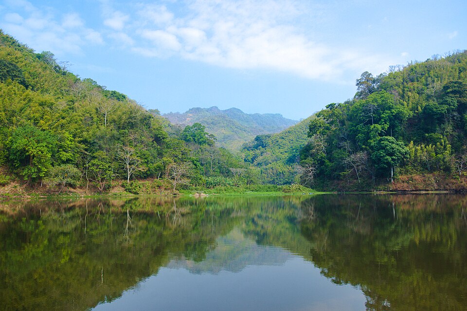
Tam Dil LakeHidden gemPhoto: Georgeluvpotato, CC0

Tam Dil Lake

A peaceful lake ringed by pine forest, a good day trip from Aizawl.

Best time: October to AprilBase: Aizawl1 dayNature
Directions
From Wikipedia

Ṭam Dil is a reservoir lake situated 6 km from Saitual, the nearest town, and 110 km from Aizawl, the capital city of Mizoram, India. Acquired by the Fisheries Department of the Government of Mizoram, it is maintained as a fish rearing site. Also as a tourist attraction, a holiday resort is maintained by the Tourism Department. The natural lake has attracted biodiversity researchers and contains several unique and rare species, particularly of amphibians and snakes.

Read more on Wikipedia ↗

Food to try

Bai (vegetable stew), sawhchiar, smoked pork, vawksa rep

Where to stay

Aizawl hotels and homestays; tourist lodges in Reiek and Champhai

Getting around

Fly into Lengpui airport near Aizawl; hired cars for the hills

Good to know

Indian visitors need an Inner Line Permit. Sundays are very quiet, as most shops close.

Mizoram: quick answers

What is the best time to visit Mizoram?

October to March

How do I reach Mizoram?

Fly into Aizawl (Lengpui). Roads connect from Silchar in Assam.

How many days do I need for Mizoram?

Plan 3 to 5 days to see the highlights, such as Aizawl, Vantawng Falls, Phawngpui (Blue Mountain).

What food should I try in Mizoram?

Bai (vegetable stew), sawhchiar, smoked pork, vawksa rep

Where should I stay in Mizoram?

Aizawl hotels and homestays; tourist lodges in Reiek and Champhai

Neighbouring states

Timings, fees, permits and road conditions change. Please check official sources before you travel.