Meghalaya
Home / Guides / Meghalaya
Northeast India · State

Meghalaya

The abode of clouds

Photo: Arshiya Urveeja Bose, CC BY 2.0
Capital

Shillong

Best time to visit

October to May (June to September for monsoon drama)

Getting there

Fly to Shillong (Umroi) or Guwahati, then take a 3-hour drive to Shillong.

Ideal trip

8 to 10 days to cover the highlights

Popular cities in Meghalaya

Been to any? Mark them on your India travel map.

DawkiJowaiMawlynnongShillongSohra (Cherrapunji)Tura

Top places in Meghalaya

Living root bridges, NongriatPhoto: Arshiya Urveeja Bose, CC BY 2.0

Living root bridges, Nongriat

The double-decker root bridge is a steep 3,500-step trek down from Tyrna village.

Best time: October to MayBase: Sohra2 daysNatureAdventure
Directions
From Wikipedia

Living root bridges are a kind of tree shaping in which rivers are spanned by bridges formed out of the roots of ficus plants. Due to their being made from living, growing trees, they "show a very wide variety of structural typologies, with various aspects of particular bridges resembling characteristics of suspension bridges, cable-stayed bridges, arches, trusses, and simply-supported beams." They are common in the Indian state of Meghalaya.

Read more on Wikipedia ↗

Video by Savvy Fernweh on YouTube

Sohra (Cherrapunji)Photo: Wikimedia Commons contributor, CC BY-SA 3.0

Sohra (Cherrapunji)

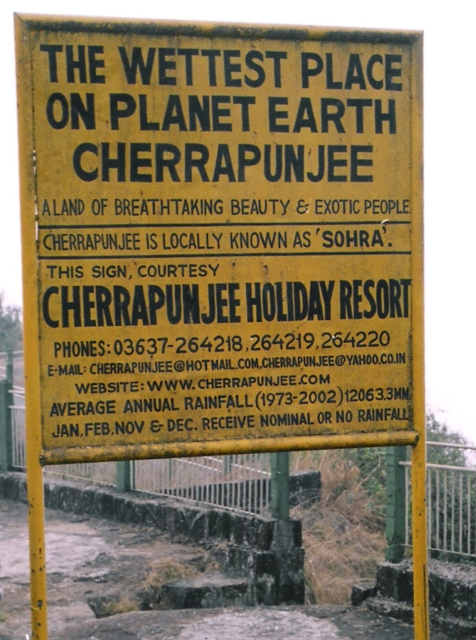
One of the wettest places on earth, with the Nohkalikai and Seven Sisters falls.

Best time: October to MayBase: Sohra2 daysNature
Directions
From Wikipedia

Cherrapunji, also known as Sohra, is a sub-divisional town in the East Khasi Hills district in the Indian state of Meghalaya. It was the traditional capital of ka hima Sohra. Sohra has often been credited as being the wettest place on Earth, but currently, nearby Mawsynram holds that distinction. Sohra still holds the all-time record for the most rainfall in a calendar month and in a year, however. It received 9,300 millimetres in July 1861 and 26,461 millimetres between 1 August 1860 and 31 July 1861.

Read more on Wikipedia ↗

Video by MUMMA'S WAY on YouTube

Dawki and the Umngot RiverPhoto: Vikramjit Kakati, CC BY-SA 4.0

Dawki and the Umngot River

A river so clear the boats seem to float on air in winter.

Best time: November to AprilBase: Dawki1 dayNature
Directions
From Wikipedia

Dawki or Dauki is a town in West Jaintia Hills district, Meghalaya, India.

Read more on Wikipedia ↗

Video by Hopping Bug on YouTube

ShillongPhoto: Prasanta Kr Dutta, CC BY-SA 4.0

Shillong

The Scotland of the East, with Ward's Lake, Elephant Falls, Police Bazaar and live music.

Best time: October to MayBase: Shillong2 daysCityMountainsFood
Directions
From Wikipedia

Shillong, the capital of Meghalaya, India, is a hill station and the headquarters of the East Khasi Hills district. It is the 330th most populous city in India, with a population of 143,229 according to the 2011 census. It is said that the rolling hills around the town reminded the British of Scotland. Hence, they would refer to it as the "Scotland of the East". Shillong has steadily grown in size since it was designated the civil station of the Khasi and Jaintia Hills by the British in 1864.

Read more on Wikipedia ↗
Nohkalikai FallsPhoto: Vikramjit Kakati, CC BY-SA 4.0

Nohkalikai Falls

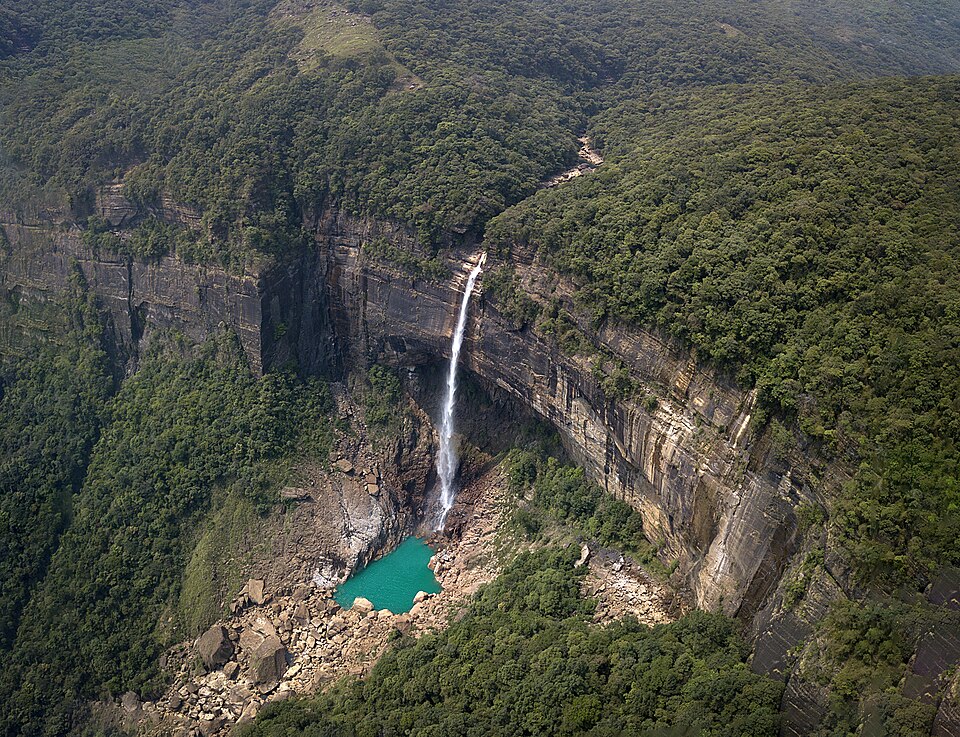
India's tallest plunge waterfall, falling 340 m into a turquoise pool near Sohra.

Best time: June to OctoberBase: Sohra1 dayNature
Directions
From Wikipedia

Nohkalikai Falls, sometimes Ka Likai, is the tallest plunge waterfall in India. The 340 metres waterfall is located in the Indian state of Meghalaya, near Cherapunji, one of the wettest places on Earth. Nohkalikai Falls are fed by the rainwater collected on the summit of a comparatively small plateau and decrease in power during the dry season, from December to February. Below the falls is a plunge pool with water of an unusual shade of green.

Read more on Wikipedia ↗
MawlynnongHidden gemPhoto: Madhumita Das, CC BY-SA 4.0

Mawlynnong

A spotless village with bamboo skywalks and a living root bridge nearby.

Best time: October to MayBase: Shillong1 dayCultureNature
Directions
From Wikipedia

Mawlynnong is a village in the East Khasi Hills district of the Meghalaya state in North East India. It is notable for its cleanliness and also was chosen by Discover India magazine as Asia's cleanest village. The village comes under the Pynursla community development block and Vidhan Sabha constituency.

Read more on Wikipedia ↗

Video by TravelWith DeeptiBhatnagar on YouTube

Mawphlang Sacred ForestHidden gemPhoto: Arshiya Urveeja Bose, CC BY 2.0

Mawphlang Sacred Forest

A centuries-old sacred grove protected by Khasi tradition, where not even a leaf may be taken out.

Best time: October to MayBase: Shillong1 dayNatureCulture
Directions
From Wikipedia

Mawphlang is a village in the East Khasi Hills district of Meghalaya state in north-eastern India, 25 kilometers from Shillong. The word maw means "stone", maw phlang means "grassy stone," and is one of many settlements in the Khasi hills named after monoliths. Mawphlang is the site of one of the Khasi Hills sacred groves. Khasi heritage village - located in the Mawphlang district - is considered to be the hub of Khasi culture. As per digital media NewsGram, the village project is in shambles.

Read more on Wikipedia ↗
Mawsynram and Mawjymbuin CaveHidden gemPhoto: Sharada Prasad CS, CC BY 2.0

Mawsynram and Mawjymbuin Cave

One of the wettest places on earth, with a natural stalagmite cave shaped like a Shiva linga.

Best time: October to MayBase: Shillong1 dayNature
Directions
From Wikipedia

Mawsynram is a town in the East Khasi Hills district of Meghalaya state in Northeastern India, 69 km from Shillong, the state capital. Mawsynram receives the highest rainfall in India. It is reportedly the wettest place on Earth, with an average annual rainfall of 11,872 millimetres. According to the Guinness Book of World Records, Mawsynram received 26,000 millimetres of rainfall in 1985. Mawsynram received 745.3 millimetres of rainfall on 19 August 2015.

Read more on Wikipedia ↗
Nartiang MonolithsHidden gemPhoto: Oliver walsher, CC BY-SA 4.0

Nartiang Monoliths

A forest garden of hundreds of standing stones, among the tallest megaliths in the world, raised by the Jaintia kings.

Best time: October to MayBase: Jowai1 dayHeritageCulture
Directions
From Wikipedia

Nartiang Durga Temple is a Hindu temple located in the West Jaintia Hills district of Meghalaya in northeastern India. It is one of the 51 Shakta pithas and is one of the holiest sites for devotees of the Shaktism sect of Hinduism. It is 600 years old. The Hindus in the Jaintia Hills believe that this temple is the permanent abode of Goddess Durga. The temple draws a large number of pilgrims from all over the country for the occasion of Durga Puja.

Read more on Wikipedia ↗

Food to try

Jadoh, doh khlieh, tungrymbai, pumaloi, Khasi pork with sesame

Where to stay

Shillong as the hub, homestays in Sohra, Nongriat and Mawlynnong

Getting around

Fly or train to Guwahati, then a 3-hour drive to Shillong; hire a car for day trips

Good to know

The Nongriat double-decker trek has about 3,500 steps each way. Carry rain gear all year.

Meghalaya: quick answers

What is the best time to visit Meghalaya?

October to May (June to September for monsoon drama)

How do I reach Meghalaya?

Fly to Shillong (Umroi) or Guwahati, then take a 3-hour drive to Shillong.

How many days do I need for Meghalaya?

Plan 8 to 10 days to see the highlights, such as Living root bridges, Nongriat, Sohra (Cherrapunji), Dawki and the Umngot River.

What food should I try in Meghalaya?

Jadoh, doh khlieh, tungrymbai, pumaloi, Khasi pork with sesame

Where should I stay in Meghalaya?

Shillong as the hub, homestays in Sohra, Nongriat and Mawlynnong

Neighbouring states

Timings, fees, permits and road conditions change. Please check official sources before you travel.