Arunachal Pradesh
Home / Guides / Arunachal Pradesh
Northeast India · State

Arunachal Pradesh

Where India greets the first sunrise

Photo: Arunachal2007, CC BY-SA 4.0
Capital

Itanagar

Best time to visit

March to June and September to November

Getting there

Fly to Guwahati, Tezpur or Itanagar (Donyi Polo Airport), then travel by road. Tawang is a two-day drive from Guwahati via Sela Pass.

Ideal trip

5 to 7 days to cover the highlights

About Arunachal Pradesh

India's largest northeastern state is a land of high passes, Buddhist monasteries and over two dozen major tribes. Indian visitors need an Inner Line Permit, which can be applied for online.

Plan a trip to Arunachal PradeshMark it on my map

Popular cities in Arunachal Pradesh

Been to any? Mark them on your India travel map.

BomdilaDirangItanagarPasighatTawangZiro

Top places in Arunachal Pradesh

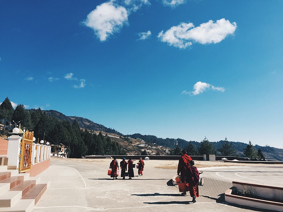
Tawang MonasteryPhoto: Rumelade, CC BY-SA 4.0

Tawang Monastery

The largest monastery in India, founded in the 17th century and sitting at about 3,000 m with sweeping views of the valley.

Best time: March to June, September to OctoberBase: Tawang2 daysSpiritualMountainsHeritage
Directions
From Wikipedia

Tawang Monastery is a Buddhist monastery located in Tawang, Arunachal Pradesh, India. It is the largest Buddhist monastery in the country. It is situated in the valley of the Tawang Chu, in close proximity to the Chinese and Bhutanese border. Tawang Monastery is known in Tibetan as Gaden Namgyal Lhatse, which translates to "the divine paradise of complete victory". It was founded by Merak Lama Lodre Gyatso in 1680–1681 in accordance with the wishes of the 5th Dalai Lama, Ngawang Lobsang Gyatso.

Read more on Wikipedia ↗

Video by jan-arend van Boeijen on YouTube
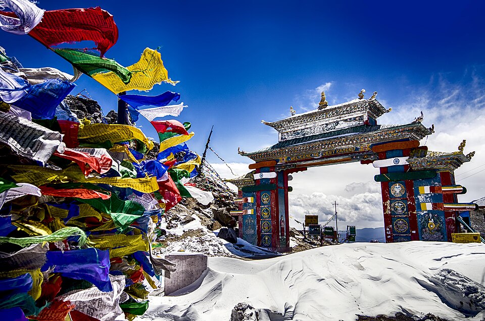
Sela PassPhoto: Dhrubazaanphotography, CC BY-SA 4.0

Sela Pass

A high-altitude pass at roughly 4,170 m with a frozen lake for much of the year, on the road to Tawang.

Best time: March to June, September to OctoberBase: Tawang1 dayMountainsAdventure
Directions
From Wikipedia

The Sela Pass is a high-altitude mountain pass located on the border between the Tawang and West Kameng districts in the Indian state of Arunachal Pradesh. It has an elevation of 4170 m and connects the Indian Buddhist town of Tawang to Dirang and Guwahati. The pass carries the National Highway 13, connecting Tawang with the rest of India. The pass supports scarce amounts of vegetation and is usually snow-covered to some extent throughout the year.

Read more on Wikipedia ↗

Video by IndianWildlifeClub - Nature Lovers Who Care on YouTube

BomdilaPhoto: TassoRija, CC BY-SA 4.0

Bomdila

A monastery town at 2,400 m on the road to Tawang, with apple orchards and wide Himalayan views.

Best time: March to June, September to NovemberBase: Bomdila1 dayMountainsCulture
Directions
From Wikipedia

Bomdila is the headquarters of West Kameng district in the state of Arunachal Pradesh in India. Bomdila is one of the 60 constituencies of the state of Arunachal Pradesh. Bomdila, a virgin forest until modern times was built as Sela Sub Agency Capital by Major Ralengnao R Khathing. In February 1954, the shifting of the Headquarters of the Political Officer from Charduar to Bomdila was undertaken, and on February 28, 1954, Bomdila was officially made the capital of the Sela Sub Agency.

Read more on Wikipedia ↗
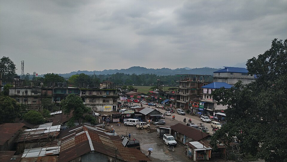
ItanagarPhoto: Mrkrish, CC BY-SA 3.0

Itanagar

The capital, with the 14th-century Ita Fort ruins, Ganga Lake and the Jawaharlal Nehru State Museum.

Best time: October to AprilBase: Itanagar1 dayCityHeritage
Directions
From Wikipedia

Itanagar is the capital and largest town of the Indian state of Arunachal Pradesh. The seat of Arunachal Pradesh Legislative Assembly, the seat of government of Arunachal Pradesh, and the seat of Gauhati High Court permanent bench at Naharlagun are all in Itanagar. Being the hub of all the major economic bases, Itanagar, along with the adjacent town of Naharlagun, comprises the administrative region of the Itanagar Capital Complex Region.

Read more on Wikipedia ↗
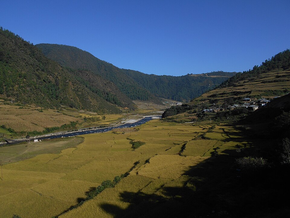
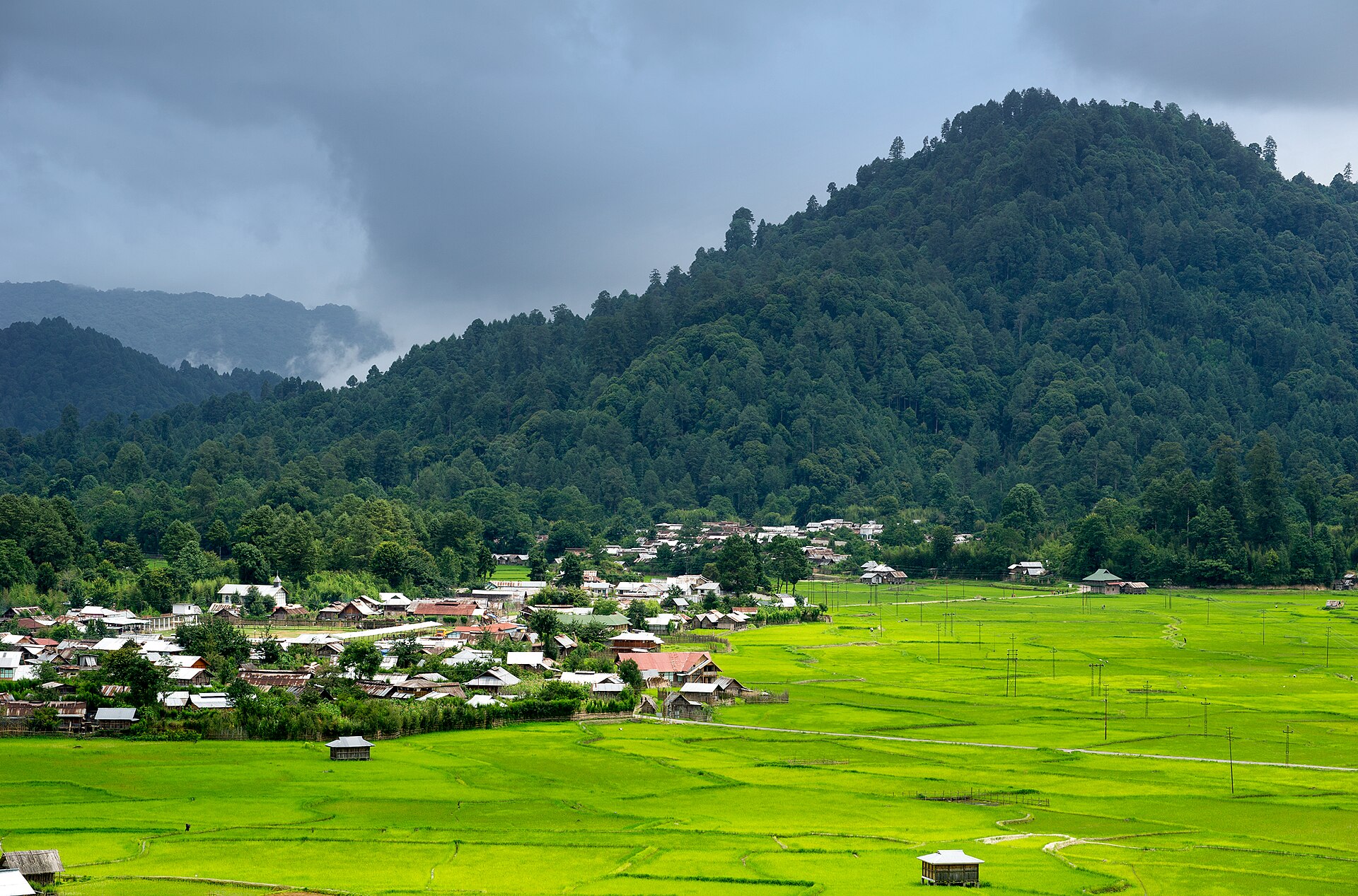
Ziro ValleyHidden gemPhoto: Arunachal2007, CC BY-SA 4.0

Ziro Valley

Pine-ringed rice fields of the Apatani people and the home of the Ziro music festival each September.

Best time: March to OctoberBase: Ziro2 daysNatureCulture
Directions
From Wikipedia

Ziro is a town in and the district headquarters of the Lower Subansiri district of the Indian state of Arunachal Pradesh. The part of the town which is the centre of economic activities and where the administrative offices are located is called Hapoli, or locally known by the Apatanis as "Hao-Polyang". Ziro is home to the Apatani tribe. Ziro is included in the Tentative List for UNESCO's World Heritage Site for the Apatani cultural landscape.

Read more on Wikipedia ↗

Video by Nino Journey on YouTube

DirangHidden gemPhoto: Itrajib, CC BY-SA 4.0

Dirang

A quiet valley stopover with hot springs, apple orchards and an old stone dzong village.

Best time: March to June, September to NovemberBase: Dirang1 dayNatureMountains
Directions
From Wikipedia

Dirang or simply Dirang H.Q. is a town on NH-13 in the district of West Kameng in the Indian state of Arunachal Pradesh. The National Institute of Mountaineering and Adventure Sports is located here. It is the location of a major geothermal power project and is proposed to become the first geothermal powered town in India.

Read more on Wikipedia ↗

Video by Shiva Tells on YouTube

Namdapha National ParkHidden gemPhoto: Rohit Naniwadekar, CC BY-SA 4.0

Namdapha National Park

Remote rainforest on the Myanmar border, one of the few parks with four big cats. Treks need a guide and permits.

Best time: October to MarchBase: Miao3 daysWildlifeNatureAdventure
Directions
From Wikipedia

Namdapha National Park is a 1,985.23 km2 large national park in Arunachal Pradesh of Northeast India. The park was established in 1983. With more than 1,000 floral and about 1,400 faunal species, it is a biodiversity hotspot in the Eastern Himalayas. It harbours the northernmost lowland evergreen rainforests in the world at 27°N latitude. It also harbours extensive dipterocarp forests, comprising the northwestern parts of the Mizoram-Manipur-Kachin rain forests ecoregion.

Read more on Wikipedia ↗

Video by Roundglass Sustain on YouTube

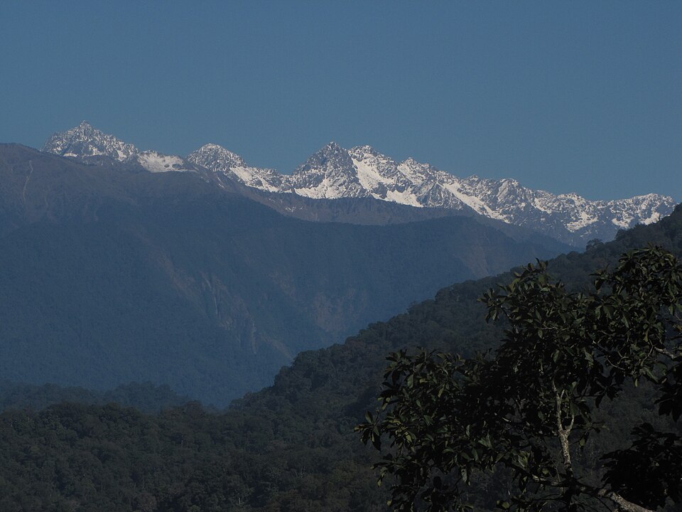
MechukaHidden gemPhoto: Quentin Talon & Mario Geiger, CC BY-SA 3.0

Mechuka

A remote, wide valley of Memba villages and a 400-year-old gompa, close to the Tibet border.

Best time: October to AprilBase: Mechuka3 daysMountainsNature
Directions
From Wikipedia

Mechuka or Menchukha is a town, assembly constituency and subdivision, situated 6,000 feet above sea level in the Menchukha Valley of Yargyap Chu/ Siyom River in Shi Yomi district of Arunachal Pradesh state of India. Before the 1950s, Mechuka valley was known as Pachakshiri. The Line of Actual Control on the India-Tibet border, 29 km north of Menchukha, separates Indian territory and Chinese territory. Mechukha has an ALG airstrip and is also reachable by one of the strategic India-China Border Roads.

Read more on Wikipedia ↗
PasighatHidden gemPhoto: Bhavikji, CC BY-SA 4.0

Pasighat

The oldest town in Arunachal, where the Siang river leaves the hills. Great for river rafting and Adi villages.

Best time: October to MarchBase: Pasighat2 daysNatureAdventure
Directions
From Wikipedia

Pasighat is the headquarters of East Siang district in the Indian state of Arunachal Pradesh. Situated at the eastern foothills of the Himalayas at 155 metres above mean sea level, Pasighat is Arunachal's oldest town. The Government of India included Pasighat in the Smart Cities Mission development scheme in June 2017. It hosts Pasighat Airport, an Advance Landing Ground of Indian Air Force.

Read more on Wikipedia ↗

Food to try

Thukpa, momos, Apong rice beer, smoked pork with bamboo shoot, Pika pila pickle

Where to stay

Bomdila or Dirang on the way to Tawang, Ziro homestays, Itanagar for the capital

Getting around

Shared Sumo jeeps and hired cars; roads are mountainous and slow, so plan short daily distances

Good to know

Indian visitors need an Inner Line Permit (apply online). Foreigners need a Protected Area Permit. Sela Pass can close after snow.

Arunachal Pradesh: quick answers

What is the best time to visit Arunachal Pradesh?

March to June and September to November

How do I reach Arunachal Pradesh?

Fly to Guwahati, Tezpur or Itanagar (Donyi Polo Airport), then travel by road. Tawang is a two-day drive from Guwahati via Sela Pass.

How many days do I need for Arunachal Pradesh?

Plan 5 to 7 days to see the highlights, such as Tawang Monastery, Sela Pass, Bomdila.

What food should I try in Arunachal Pradesh?

Thukpa, momos, Apong rice beer, smoked pork with bamboo shoot, Pika pila pickle

Where should I stay in Arunachal Pradesh?

Bomdila or Dirang on the way to Tawang, Ziro homestays, Itanagar for the capital

Neighbouring states

Timings, fees, permits and road conditions change. Please check official sources before you travel.